I am Costa Rican. I have spent most of my adult life pointing a camera at this country. I know its forests, its coasts, its rivers, its birds. And yet, until last March, I had never stood on its highest ground.
Cerro Chirripó is 3,820 meters above sea level. It is the tallest peak in Costa Rica, the tallest in Panama, the tallest anywhere in southern Central America until you reach the Colombian Andes. It sits in the Talamanca range, the same range I have walked at lower elevations chasing quetzals and tapirs for years. And I had never climbed it. I had looked at it, from the roads near Cerro de la Muerte, watching clouds climb its flanks. I had pointed other people’s attention at it. But I had never put my boots on its trail.
Last year, I decided to stop looking and start walking.
The Trailhead
The trail begins in San Gerardo de Rivas, a small town at 1,500 meters on the Pacific side of the Talamanca. At five in the morning, it is cold in a way the lowlands are not. Your breath shows. Dogs bark from somewhere on the hill. The first light is still an hour away.
You register at the park office. You weigh your pack. You check your headlamp. And then you start walking.
The first kilometers are rainforest, warm and loud. Heliconia leaves as wide as your shoulders. Clay earth. Cicadas tuning up as the light arrives. The trail climbs at a pitch that feels polite for the first thirty minutes and brutal for the thirty after that.
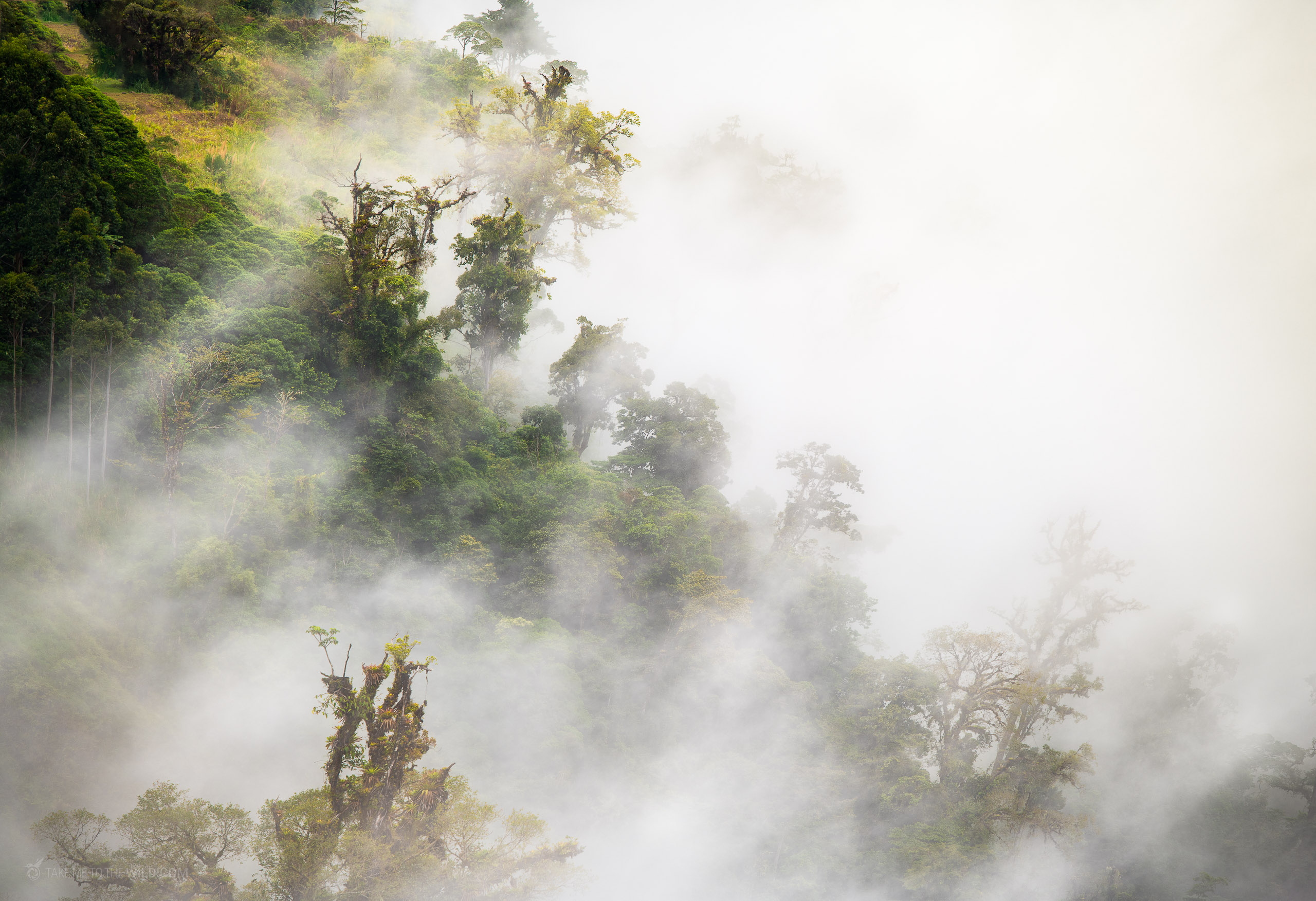
Into the Cloud Forest
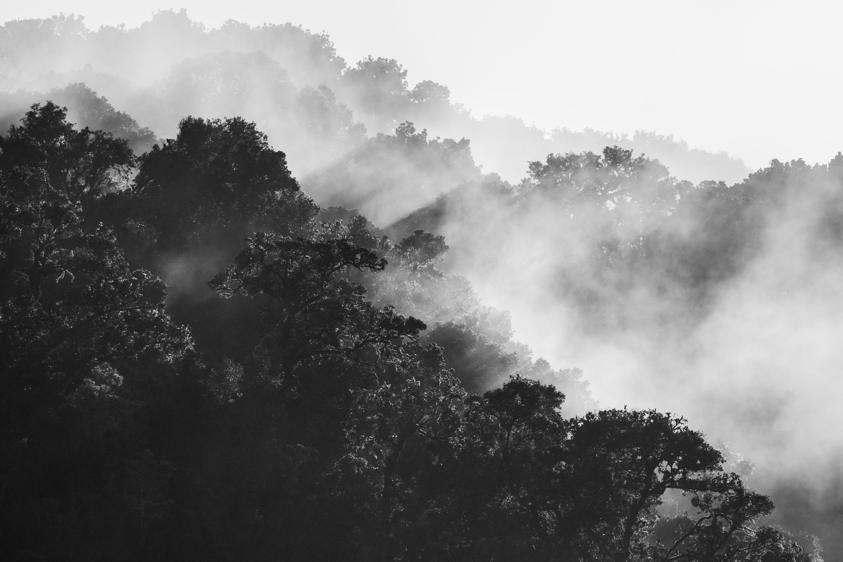
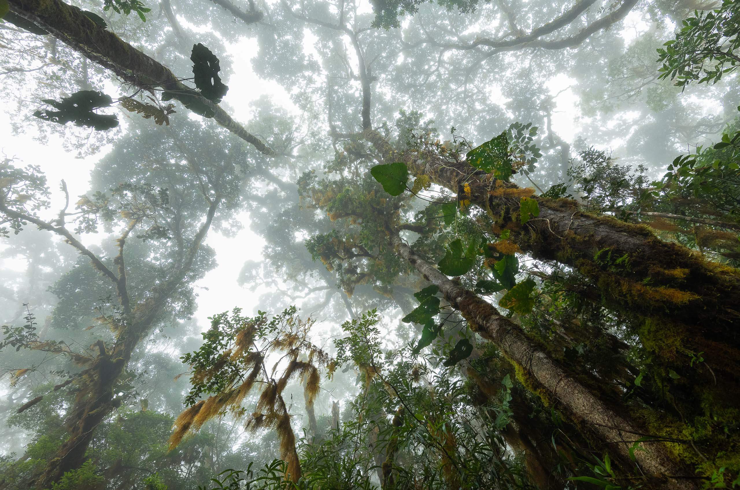
The forest changes around 2,300 meters, and you feel the change before you see it. The air gets colder and wetter. Something in the quality of the light shifts. Leaves that were broad and tropical shrink and thicken. The trees begin to wear moss the way older people wear sweaters: layered, casual, permanent.
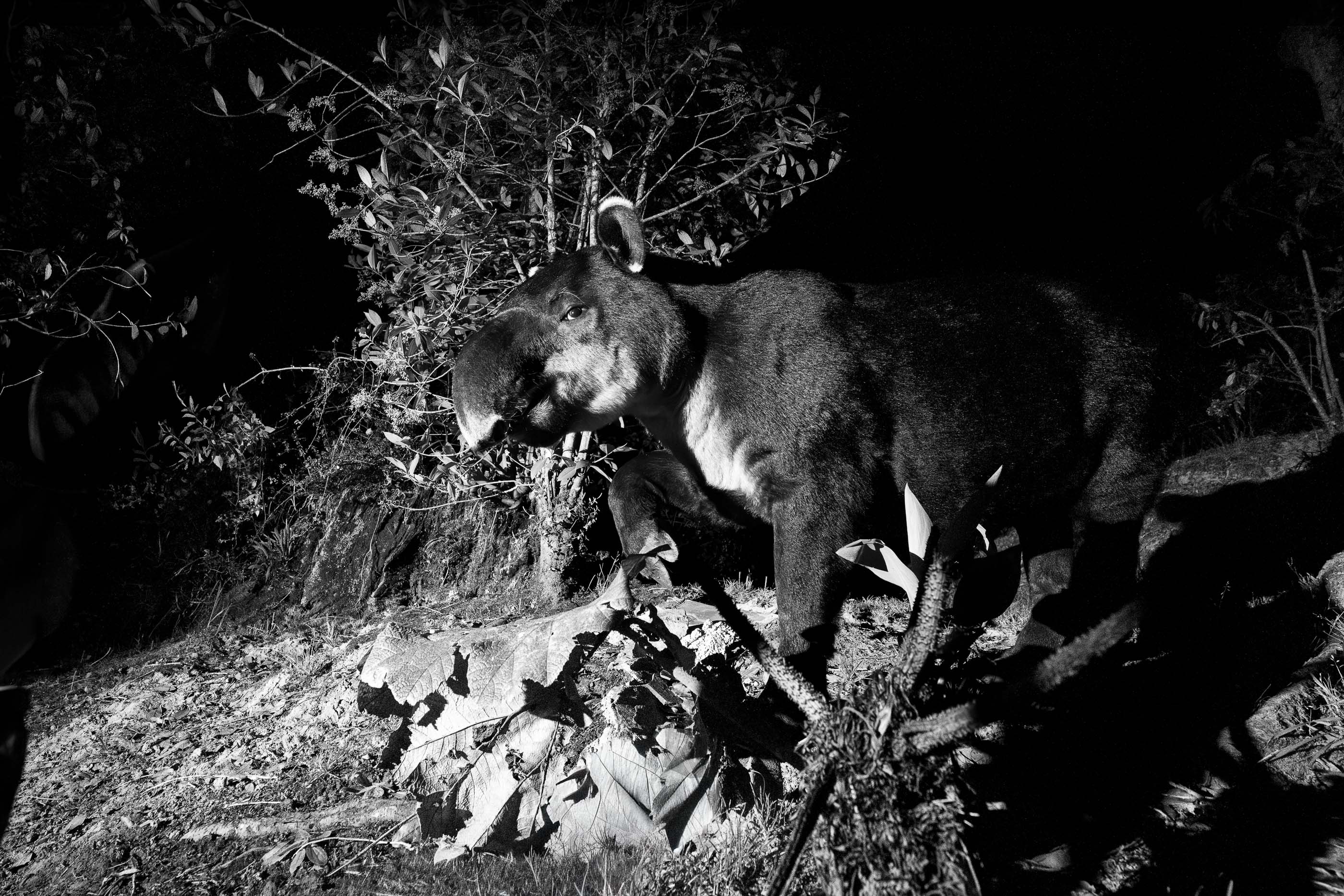
This is the cloud forest. It is the Costa Rica I know best. I have spent hundreds of hours here with a tripod, looking for quetzals in the mist, listening for the soft thud of a Baird’s tapir moving through the understory. Every oak is a world. Every branch is carrying a bromeliad, a lichen, a fern, an orchid. Nothing here is unoccupied.
What surprises me is that I am moving through it without my camera in my hand. Today is not a photography day. Today, the forest is not a subject. Today, I am just passing through, and it is strange to be a guest in a place where I have usually been a watcher.
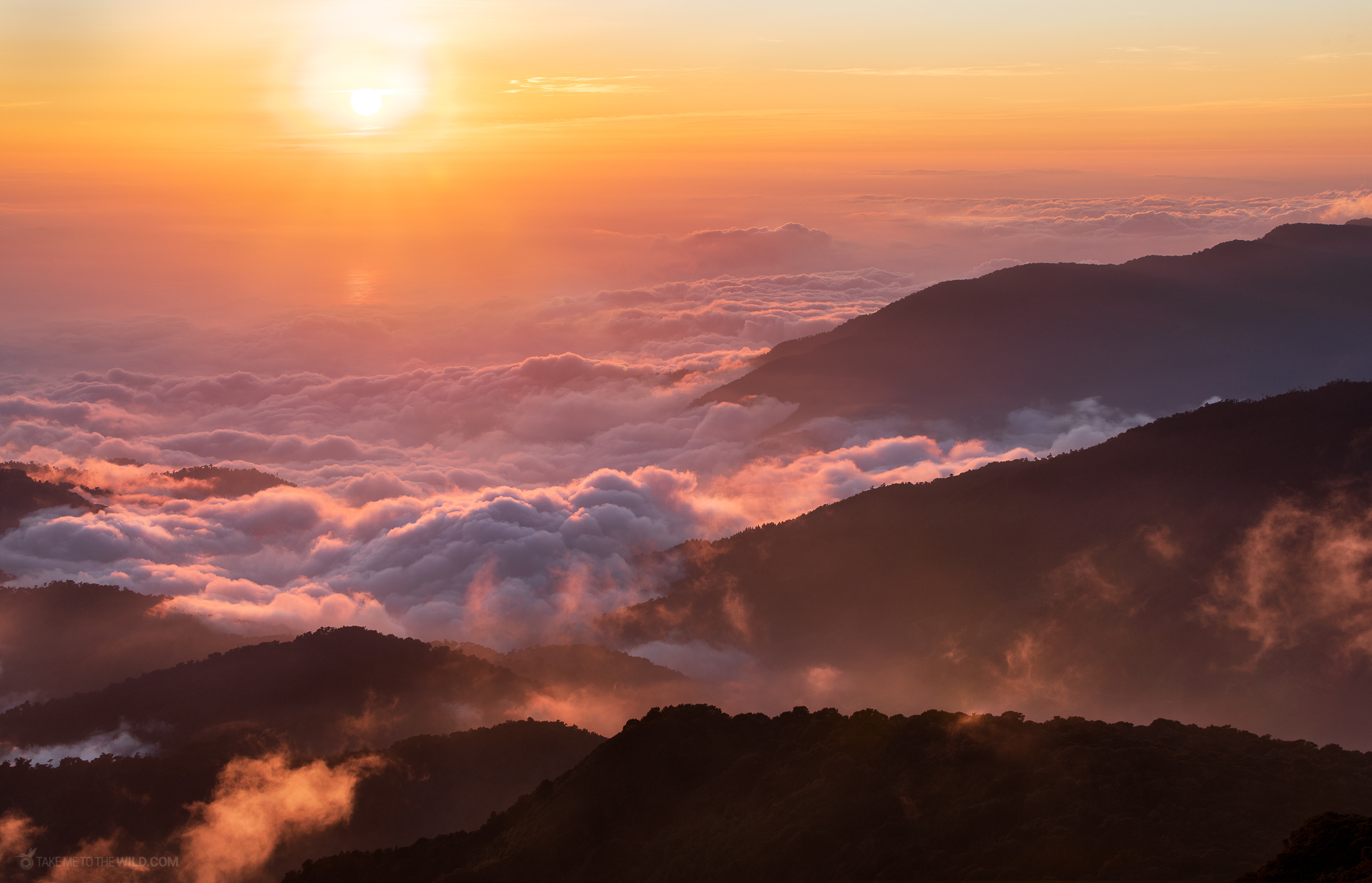
Above the Clouds
Around 3,000 meters, the forest begins to let go. The oaks grow shorter. Their branches grow sideways rather than up. The moss thins. Bamboo takes over in places. You realize, without quite noticing when, that you are higher than the clouds.
There is a name for this zone in the Talamanca, the elfin forest. The plants here are stunted by wind and by cold, not by age. They are old. They are just the right size to survive at this altitude. Nothing is wasted. Nothing grows taller than the wind will allow.
It is harder to breathe, too. Not dangerous yet, but noticeable. Every step costs a little more. Every ridge I crest reveals another ridge.
Base Crestones, 3,400m
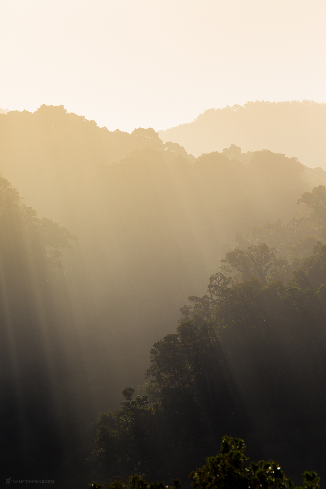
You arrive at Base Crestones in the late afternoon. The refuge is plain, concrete, cold. You are exhausted. Your pack has become a small resentment. You peel off wet layers, put on dry ones, and drink hot water that tastes like the best thing you have ever tasted.
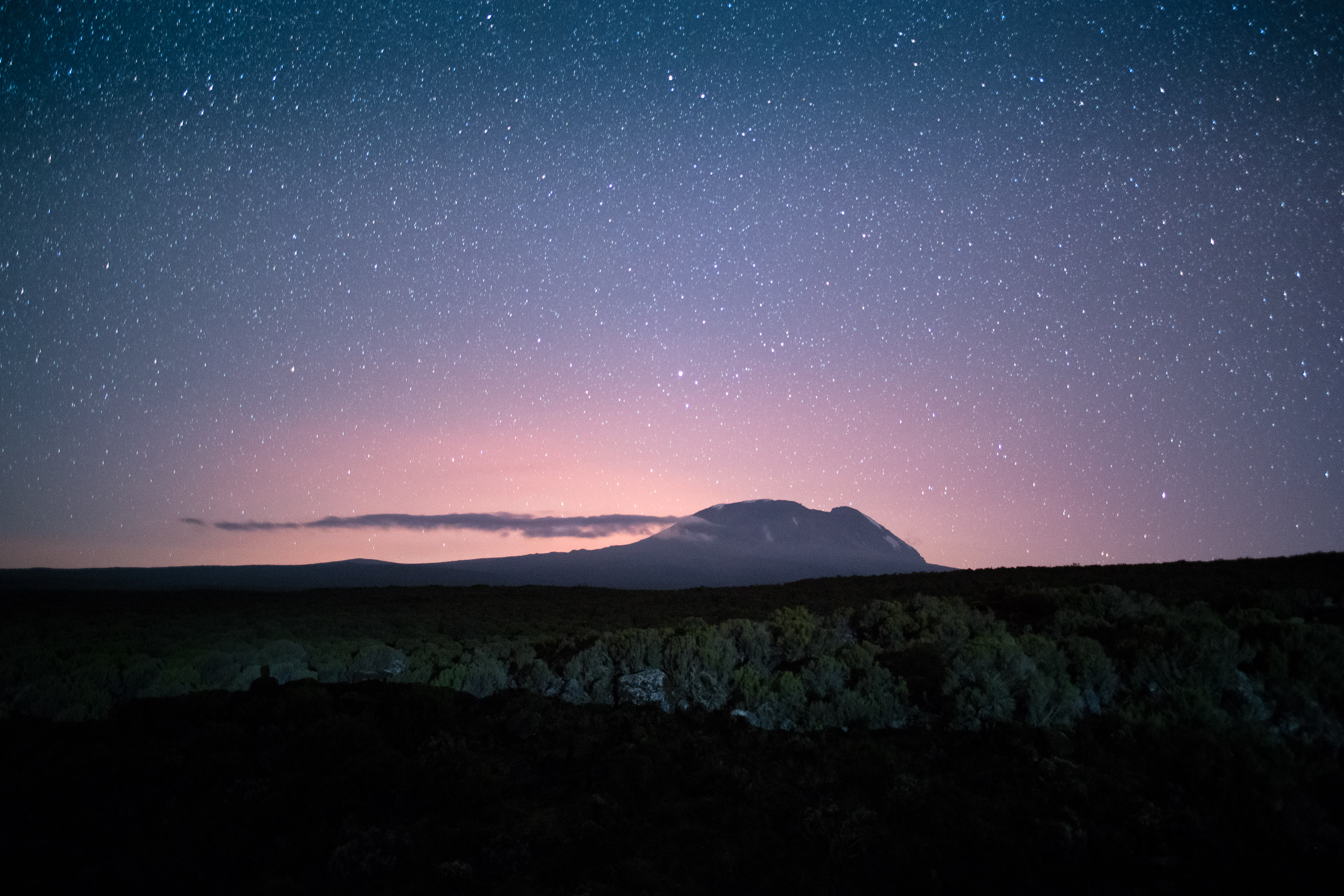
The sun drops fast at this altitude. By six, it is below freezing. By seven, it is dark. And at this elevation, when the sky is clear, the dark is not the dark of a city or a lowland forest. It is something older.
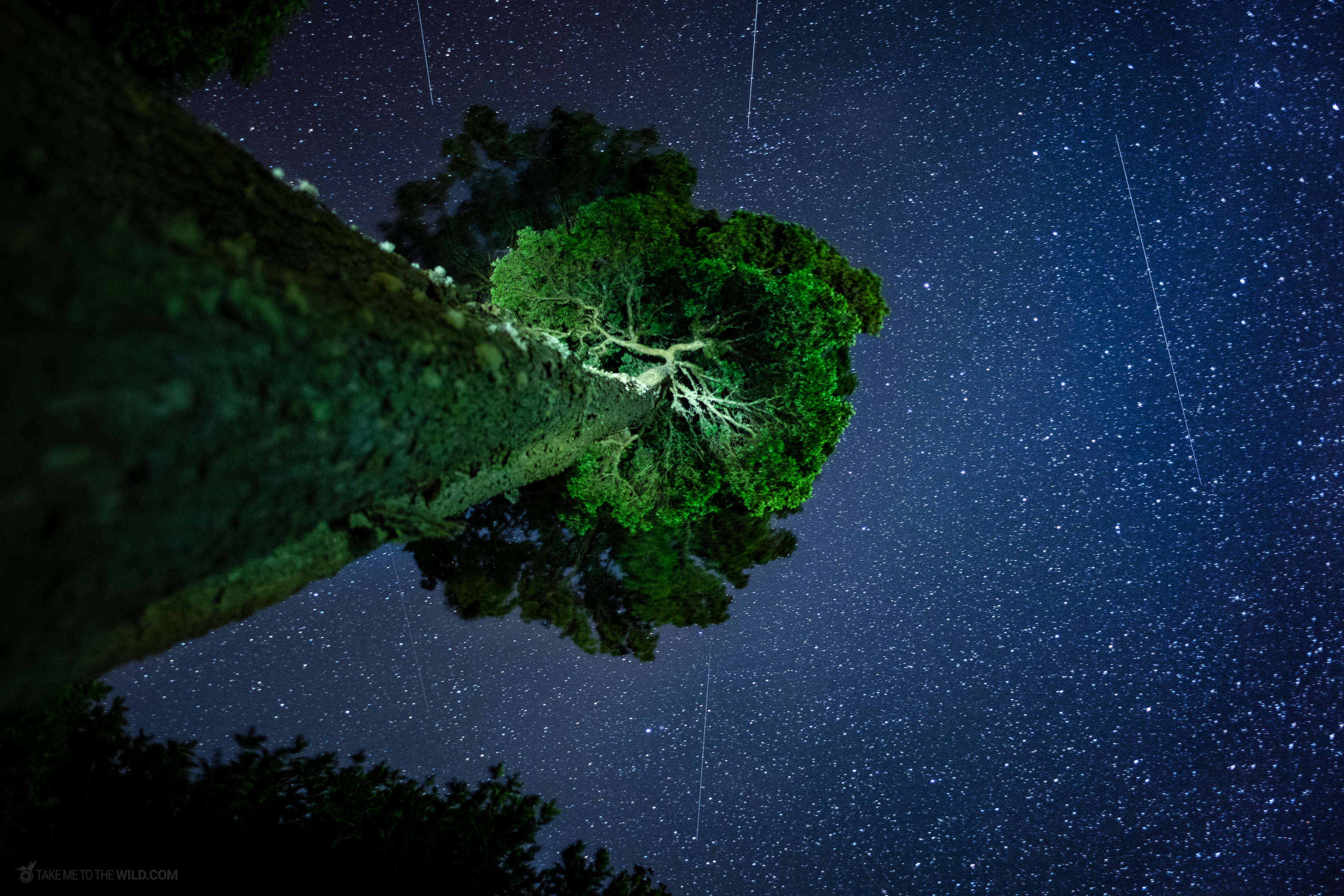
“At this elevation, when the sky is clear, the dark is not the dark of a city or a lowland forest. It is something older.”
I stand outside the refuge longer than I should. The cold goes through my jacket and finds the skin of my stomach. I cannot tell if I am shivering because of the temperature or because the sky is this full. There is no moon yet. The stars feel close enough that you can see depth in them. Some are nearer. Some are farther. You can see the space between them.
The Moon Over Los Crestones
The alarm goes off at three in the morning. The cold is not metaphorical anymore. You put on every layer you have, you clip on the headlamp, you leave the refuge.
The trail climbs for another hour, in the dark, over loose rock. Your legs are stiff from yesterday. Your lungs still do not have enough air. You move slowly. You pass other headlamps moving slowly. Nobody is talking.
And then, at some point, I look up and see Los Crestones for the first time.
The granite towers stand above the ridgeline, lit by a late moon. They look prehistoric. Teeth, or a spine, or the exposed bone of the mountain itself, lifted out of the ground for anyone willing to walk far enough to see it.
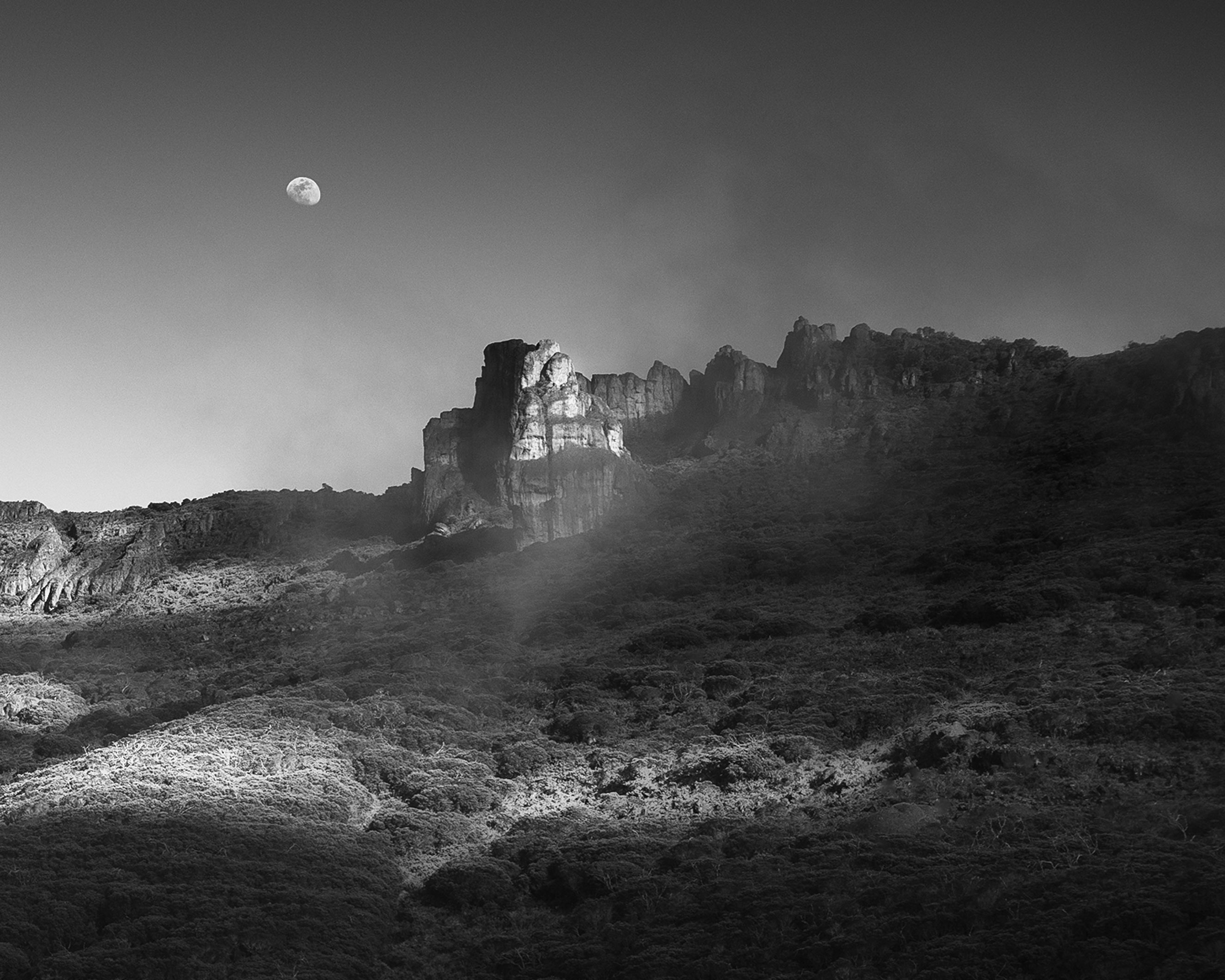
I stop moving. My camera does not come out right away. I just stand there. The cold goes all the way through me and I do not care. I am looking at the country I grew up in, from a height I have never seen it from before, under a light I have never seen it in.
It is the kind of moment the mountain gives you in exchange for everything you spent getting here.
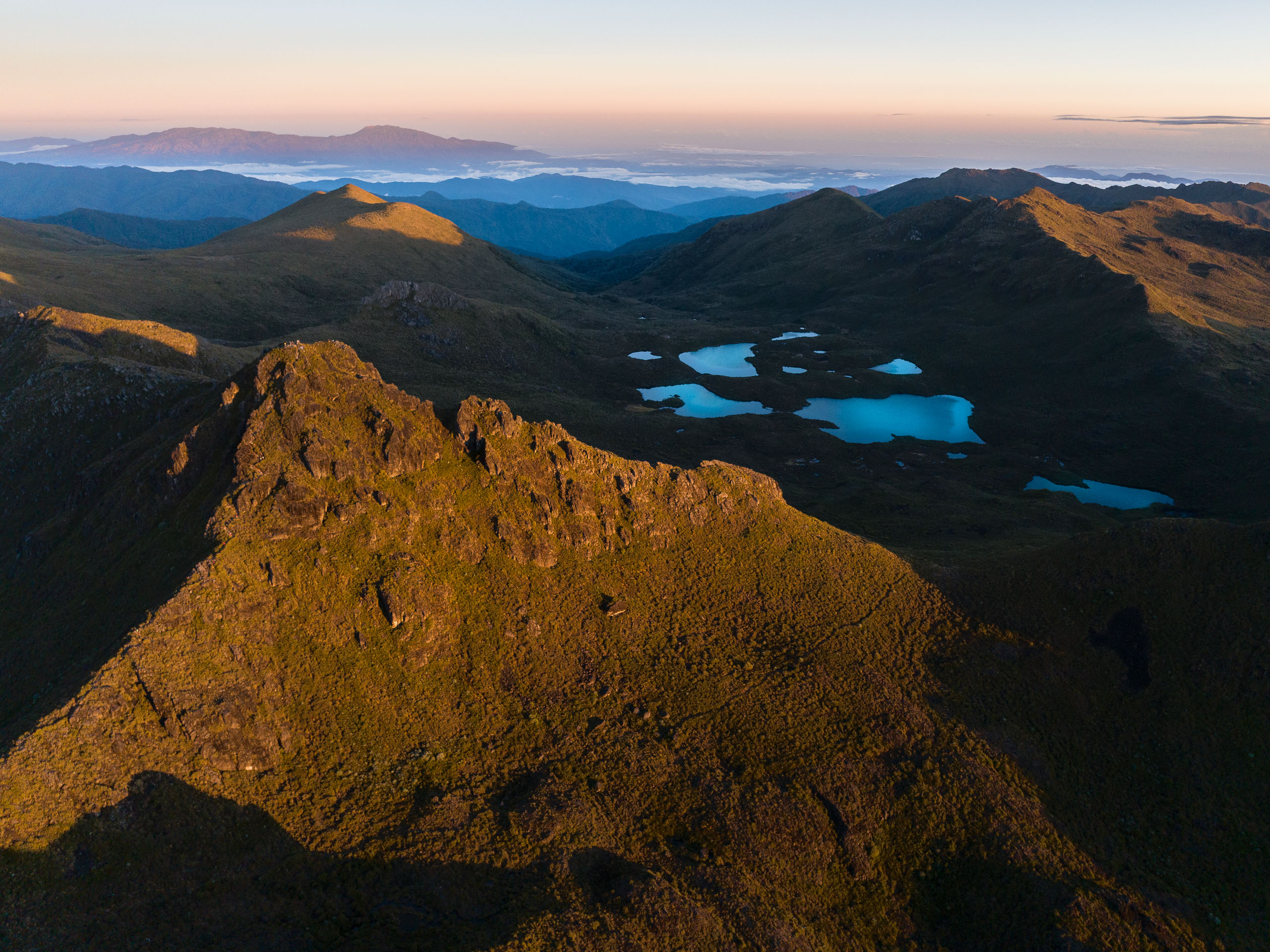
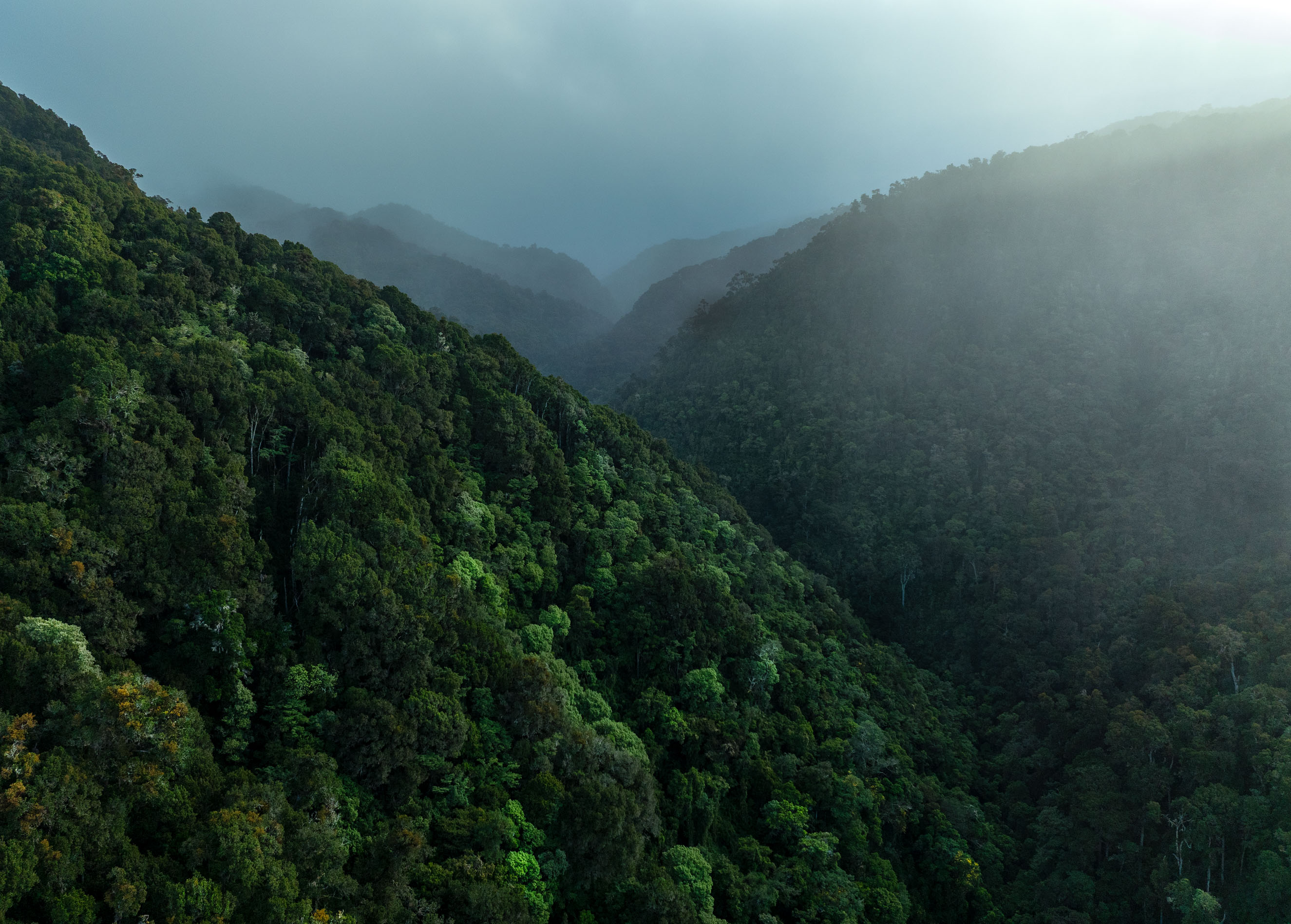
The Páramo and the Lakes
First light pours over the ridgeline and into the páramo. The landscape is not what Costa Rica is supposed to look like. There are no palms. There are no tall trees. There is alpine grass the color of straw, low shrubs bent by wind, volcanic rock. There are valleys scooped out by glaciers that disappeared from this country more than ten thousand years ago.
The name Chirripó comes from the Cabécar people, and is often translated as a place of eternal waters. The glaciers left behind a chain of small alpine lakes, and on a still morning like this one, the lakes sit mirror-flat, holding the sky inside them.
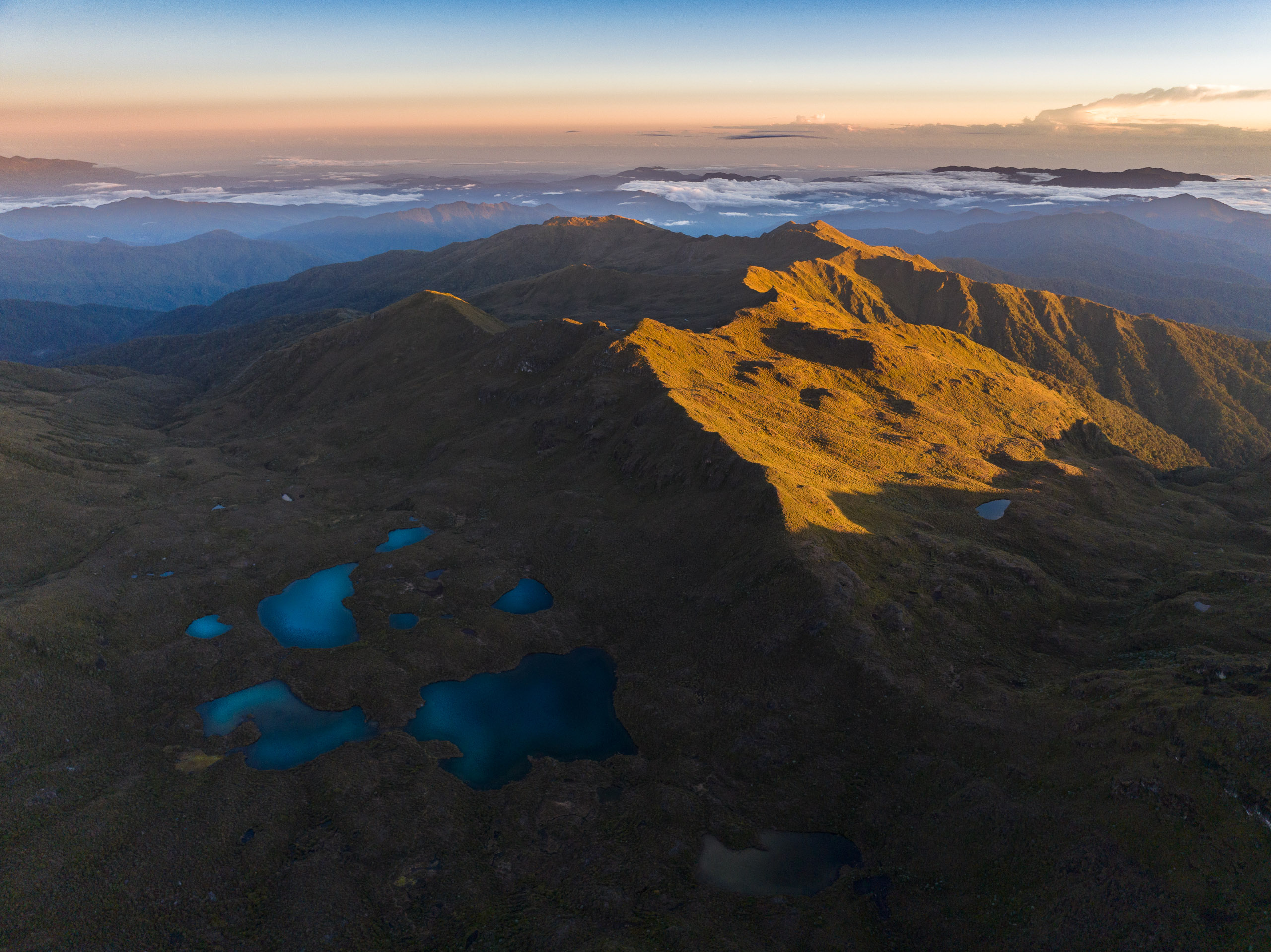


I walked this zone in a quiet I rarely get to have. I kept expecting to round a corner and see a howler monkey, a toucan, a familiar emblem of Costa Rica. I never did. This ecosystem belongs to something else. Volcano juncos, coyotes, sometimes a resplendent quetzal dropping in from the cloud forest just below. Everything that lives up here is specialized for up here.
Los Quemados
On the way across the páramo, you pass through a zone the guides call Los Quemados. The burned ones. In 2012, and again in 2019, fires swept through this part of Chirripó, destroying sections of páramo and elfin forest that may take decades or centuries to recover, if they recover at all.
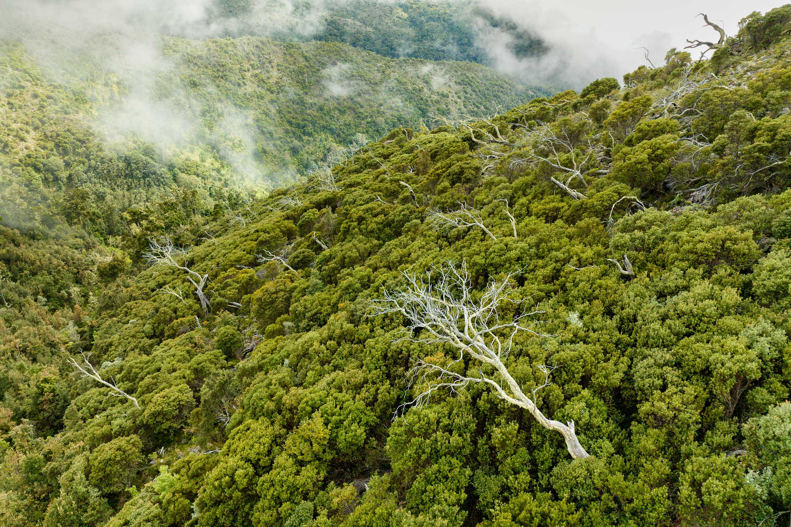
The páramo was never supposed to burn like this. It is a cold, wet ecosystem, historically too damp to carry flame. But the climate is changing, and the cloud line is moving. The mist that once soaked these slopes is forming higher in the atmosphere, and what used to be wet is now dry for longer stretches of the year. Fires that once would have sputtered out now run for days. The roof of Costa Rica is drying out.
From the ground, Los Quemados is patchy. Pale grass, black char, a few enebros still standing, blackened but alive. From the air, it looks like a map of something we are doing wrong.
The Descent
You walk back down the way you came up. Same kilometers, same knees, opposite gravity. The altitude loosens its grip as you drop. Breathing returns. Your pack somehow weighs more going down than it did going up.
At some point in the descent, I realized I had not been thinking about my work for almost two days. No emails. No trip planning. No shot list. Just the trail, my breath, and the thing the mountain kept showing me.
I came home with sore legs and a lasting understanding of a shape I had only known from the outside. My country has a roof. Most of the people who live in it have never been up there. Most will never go. And most who go, like me, will only go once.
But that one time, if you are willing to suffer the 14 kilometers and the cold and the thin air, the mountain gives you something you cannot get any other way. It gives you your country from above its own weather. And it gives you a reminder that even a place you thought you knew has heights you have never stood on.
Written with BlueTip 🦋
Gear
The photography gear used in this story.
Accessories
- Peak Design Travel Tripod
- F-stop 50L Mountain Series Tilopa Backpack
Related Topics